Once upon a time, the concept of having a mobile phone in your pocket was alien, the idea of pulling up an interactive 360-degree map and plotting your exact route to work down to the minute was unthinkable. Technology moves on and the way we operate changes.
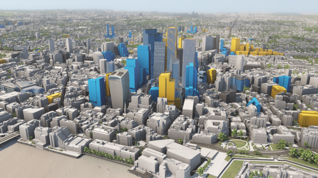
When we founded VU.CITY in 2017, we wanted to develop a new kind of tech that could have the same kind of far-reaching impact for people. Something that wouldn’t just be about visualising places differently, but about making them better. We set to work building an interactive platform to do just that, and what began as a small start-up with a website has since grown to become the world’s largest and most accurate 3D digital twin of cities, accurate to within 15cm – paving the way for transformative change in the way our cities are planned and created.
The best city possible for all
Within the world of the built environment and real estate, the game-changing potential for PropTech (property technology) has long been recognised, but recent events have propelled it into the mainstream and accelerated the need for change. The pandemic had a profound impact on the way we think about construction and caused many of us to take stock and reflect on the way we use and interact with the spaces around us. Monumental changes were forced to the fore: lockdown sent thousands of city workers into their houses leading to questions about the very future of the office, people made new friends and connections while dining al fresco in temporarily pedestrianised streets, while the entire population of London discovered new walks in their area while getting their daily hour of exercise. As we return to a semblance of ‘normality’, we must not forget to pay attention to the spaces we inhabit and the buildings around us. There is a real opportunity for innovation and for decision-makers to adopt smart technologies like ours to build better and more sustainable cities.

Shaking things up
The planning system needs modernising. Have you ever taken the time to read a printed planning notice pinned up on a lamp post? If you asked for a show of hands of how many people had actively taken part in a public consultation, I suspect it would be limited at best. And why would people try to get involved in shaping the neighbourhood around them when the system can appear so confusing and inaccessible? In the same year we sent Richard Branson into space, we still see planning applications submitted with hundreds of complex documents which are then filed away in an online planning portal that most people in the local community will never see. We’ve seen digital innovation in almost all areas of life, from consumer technology to medtech and education, but planning and development remains firmly stuck in the past. Showing planned developments in 3D and in context engages local residents and allows them to look at proposals from unlimited viewpoints. We’ve already seen PropTech pioneers leading the charge, such as the London Legacy Development Corporation (LLDC). In mid-2020, LLDC appointed VU.CITY and Commonplace to ensure the community was involved meaningfully in decisions that shaped the future of their neighbourhood at Queen Elizabeth Olympic Park, an important London heritage site. It’s time to shake things up and a disruptive platform like ours has the key to unlock
that change.

Giving people a voice
Cast your mind back to our showing of hands. It was minimal. Ask those very same people if they like the park and playground near the house they grew up in and whether they would like to see it upgraded with better facilities, more pedestrian access and cycle routes, then no doubt they would have an opinion. As they should. Changes to the built environment impact all our lives, from the roads we walk from our own front door to the areas in which our children play and the views of London we see from our office windows. It doesn’t have to be this hard to involve people in the process. Immersive digital twins can help. Using digital plans and platforms can demystify the planning process and build trust. Citizens can see and understand the impact of new developments, navigating this information easily. In turn, these tools will equip developers with the knowledge they need to propose hyper-local projects that meet the needs of the community, while also ensuring profit.

Building better
Did you know that every single building proposed needs to go through a daylight and sunlight assessment? That some views are protected – like that of St. Paul’s from Hampstead Heath – while others aren’t? Now, I’m not suggesting we all go away and memorise the dictionary of planning jargon – save that for the architects, developers and councillors – however, it’s important to recognise that a lot of thought goes into creating buildings that look good, function well and complement their surroundings.
Using digital tools and rich data layers can reduce the uncertainty of planning, speed up crucial design decisions and reduce the huge financial investment that is traditionally required at the outset of a project. Being able to show proposals digitally helps to de-risk the process for developers and councils, enabling a more collaborative approach and preventing the risk of an eyesore being built at the end of the project. With more collaboration at all stages of the process, we can help ensure the right buildings are built in the
right place.
Scaling up
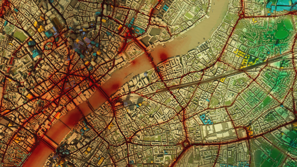
VU.CITY has already been adopted by nearly 90% of London boroughs as well as more than 30 other cities in the UK and internationally, but we know our journey has just begun. We recognise the magnitude of the opportunity – there is potential to harness city data at an even bigger scale, everything from traffic flow data to energy certificates and carbon emissions outputs. With the UN predicting that 68% of the world’s population will live in cities by 2050, the time is now to embed this technology to inform net zero strategies and build future-proofed cities fit for future generations.
Find our more about VU.CITY at www.vu.city

Jamie Holmes, CEO at VU.CITY

